
Mapa topográfico Mahendragiri
Mapa interactivo
Haga clic en el mapa para ver la altitud.
Acerca de este mapa
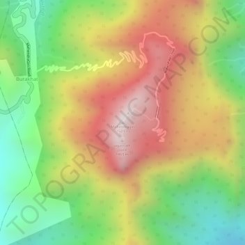
Nombre: Mapa topográfico Mahendragiri, altitud, relieve.
Altitud media: 1,108 m
Altitud mínima: 711 m
Altitud máxima: 1,494 m
Mahendragiri, is a mountain in Rayagada block of the district of Gajapati, Odisha, India. It is situated amongst the Eastern Ghats at an elevation of 1,501 metres (4,925 ft).It is second biodiversity Heritage Site of Odisha. This is considered as one out of Seven Kula Parvat of India.
Otros mapas topográficos
Haga clic en un mapa para ver su topografía, su altitud y su relieve.
Eastern Ghats
India > Odisha > Ramagiri > Burakhat
Eastern Ghats, Burakhat, Ramagiri, Gajapati District, Odisha, India
Altitud media: 1,130 m