
Gracias por apoyar a este sitio ❤️
Haz una donación
Haz una donación
Mapa topográfico Kamieskroon
Haga clic en el mapa para ver la altitud.
Gracias por apoyar a este sitio ❤️
Haz una donación
Haz una donación
Kamieskroon
Kamieskroon is a small town in the Kamiesberg Local Municipality, lying in the foothills of the Kamiesberge at an elevation of approximately 800 m (2 600 ft). The town is more or less in the centre of Namaqualand, about 70 km (43 mi) to the south of Springbok, Northern Cape, South Africa. It is known mainly for its abundance of wild flowers during spring.
Gracias por apoyar a este sitio ❤️
Haz una donación
Haz una donación
Acerca de este mapa
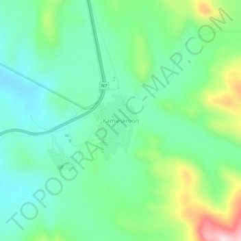
Nombre: Mapa topográfico Kamieskroon, altitud, relieve.
Altitud media: 789 m
Altitud mínima: 676 m
Altitud máxima: 1,071 m
Gracias por apoyar a este sitio ❤️
Haz una donación
Haz una donación