
Mapa topográfico Dowling
Haga clic en el mapa para ver la altitud.
Acerca de este mapa
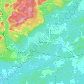
Nombre: Mapa topográfico Dowling, altitud, relieve.
Altitud media: 294 m
Altitud mínima: 254 m
Altitud máxima: 428 m
Otros mapas topográficos
Haga clic en un mapa para ver su topografía, su altitud y su relieve.
Lake Laurentian Conservation Area
Canada > Ontario > Sudbury District > Greater Sudbury > McFarlane Lake
Altitud media: 264 m
Lake Laurentian
Canada > Ontario > Sudbury District > Greater Sudbury > McFarlane Lake
Altitud media: 270 m