
Mapa topográfico Bhilai
Mapa interactivo
Haga clic en el mapa para ver la altitud.
Acerca de este mapa
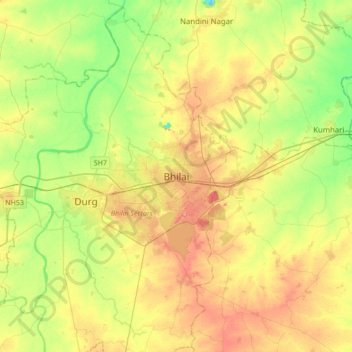
Nombre: Mapa topográfico Bhilai, altitud, relieve.
Lugar: Bhilai, Durg Tahsil, Durg, Chhattisgarh, 490023, India (21.05207 81.21328 21.37207 81.53328)
Altitud media: 292 m
Altitud mínima: 255 m
Altitud máxima: 335 m
Bhilai lies at 21.21°N 81.38°E in Central India at an elevation of 297m above sea level on the banks of the Shivnath river, a tributary of the river Mahanadi. It covers an area of 341 km2 (132 sq mi).
Otros mapas topográficos
Haga clic en un mapa para ver su topografía, su altitud y su relieve.
Durg
India > Chhattisgarh > Durg Tahsil
Durg, Durg Tahsil, Durg District, Chhattisgarh, 491002, India
Altitud media: 295 m