
Mapa topográfico Port-Morin
Mapa interactivo
Haga clic en el mapa para ver la altitud.
Acerca de este mapa
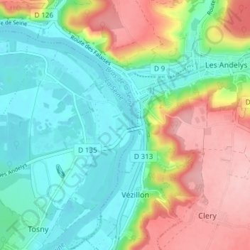
Nombre: Mapa topográfico Port-Morin, altitud, relieve.
Altitud media: 63 m
Altitud mínima: 6 m
Altitud máxima: 164 m
Otros mapas topográficos
Haga clic en un mapa para ver su topografía, su altitud y su relieve.
Venables
France > Normandie > Eure > Les Trois Lacs
Venables, Les Trois Lacs, Les Andelys, Eure, Normandie, France métropolitaine, 27940, France
Altitud media: 61 m
Tosny
France > Normandie > Eure > Les Trois Lacs
Tosny, Les Trois Lacs, Les Andelys, Eure, Normandie, France métropolitaine, 27700, France
Altitud media: 38 m
Bernières-sur-Seine
France > Normandie > Eure > Les Trois Lacs
Bernières-sur-Seine, Les Trois Lacs, Les Andelys, Eure, Normandie, France métropolitaine, 27700, France
Altitud media: 30 m