
Mapa topográfico Lawrence
Mapa interactivo
Haga clic en el mapa para ver la altitud.
Lawrence
Downtown Lawrence is located at 38°58′18″N 95°14′7″W / 38.97167°N 95.23528°W / 38.97167; -95.23528 (38.959902, −95.253199), approximately 25 miles (40 kilometers) east of Topeka, and 35 mi (56 km) west of Kansas City, Kansas. Though Lawrence has a designated elevation of 866 feet (264 m), the highest elevation is Mount Oread on the University of Kansas campus with an elevation of 1,020 feet (310 m).
Acerca de este mapa
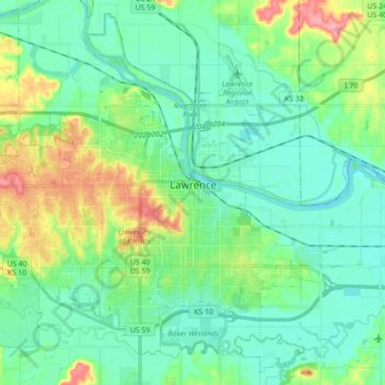
Nombre: Mapa topográfico Lawrence, altitud, relieve.
Lugar: Lawrence, Douglas County, Kansas, United States of America (38.90447 -95.34463 39.03350 -95.16662)
Altitud media: 265 m
Altitud mínima: 241 m
Altitud máxima: 333 m