
Mapa topográfico Rancho Santa Fe
Mapa interactivo
Haga clic en el mapa para ver la altitud.
Acerca de este mapa
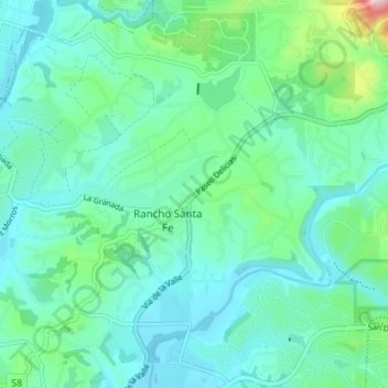
Nombre: Mapa topográfico Rancho Santa Fe, altitud, relieve.
Altitud media: 68 m
Altitud mínima: 6 m
Altitud máxima: 331 m
The climate of Rancho Santa Fe is, for the most part, typical of the San Diego metropolitan area though its higher elevation and inland location lends itself to larger temperature variations.