
Mapa topográfico Srinagar
Haga clic en el mapa para ver la altitud.
Acerca de este mapa
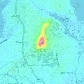
Nombre: Mapa topográfico Srinagar, altitud, relieve.
Altitud media: 1,598 m
Altitud mínima: 1,580 m
Altitud máxima: 1,737 m
Otros mapas topográficos
Haga clic en un mapa para ver su topografía, su altitud y su relieve.
Dal Lake
India > Jammu and Kashmir > Srīnagar > Srinagar
The average elevation of the lake is 1,583 metres (5,194 ft). The depth of water varies from 6 metres (20 ft) at its deepest in Nigeen lake to 2.5 metres (8.2 ft), the shallowest at Gagribal. The depth ratio between the maximum and minimum depths varies with the season between 0.29 and 0.25, which is…
Altitud media: 1,715 m