
Mapa topográfico Cumbum
Haga clic en el mapa para ver la altitud.
Cumbum
Cumbum is located at 9°44′N 77°18′E / 9.73°N 77.3°E / 9.73; 77.3. It has an average elevation of 391meters (1282 feet). One can see the backdrop of Kodaikanal Hills from Cumbum. Apart from that Cumbum has most vigorous activity in agriculture.
Acerca de este mapa
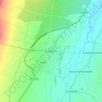
Nombre: Mapa topográfico Cumbum, altitud, relieve.
Lugar: Cumbum, Uthamapalayam, Theni, Tamil Nadu, 625516, India (9.69941 77.24530 9.77941 77.32530)
Altitud media: 432 m
Altitud mínima: 370 m
Altitud máxima: 612 m