
Mapa topográfico Mill Creek Point
Mapa interactivo
Haga clic en el mapa para ver la altitud.
Acerca de este mapa
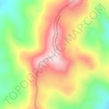
Nombre: Mapa topográfico Mill Creek Point, altitud, relieve.
Altitud media: 1,275 m
Altitud mínima: 1,038 m
Altitud máxima: 1,498 m
Otros mapas topográficos
Haga clic en un mapa para ver su topografía, su altitud y su relieve.
Pend Orielle River
United States > Washington > Pend Oreille County
Pend Orielle River, Pend Oreille County, Washington, United States
Altitud media: 1,060 m
Sacheen Lake
United States > Washington > Pend Oreille County
Sacheen Lake, Pend Oreille County, Washington, United States
Altitud media: 715 m
Metaline Falls
United States > Washington > Pend Oreille County
Metaline Falls, Pend Oreille County, Washington, 99153, United States
Altitud media: 720 m