
Mapa topográfico Begusarai
Haga clic en el mapa para ver la altitud.
Begusarai
Begusarai is located at 25°25′N 86°08′E / 25.42°N 86.13°E / 25.42; 86.13. It has an average elevation of 41 metres (134 feet). Begusarai lies in North Bihar and is surrounded by Khagaria in the northeast, Munger in the southeast, Patna in the west, and Samastipur in the northwest.
Acerca de este mapa
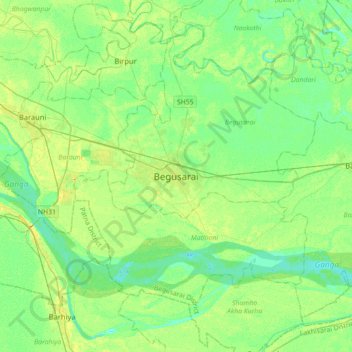
Nombre: Mapa topográfico Begusarai, altitud, relieve.
Lugar: Begusarai, Bihar, 851117, India (25.25391 85.97488 25.57391 86.29488)
Altitud media: 41 m
Altitud mínima: 32 m
Altitud máxima: 55 m