
Mapa topográfico Schauinsland
Mapa interactivo
Haga clic en el mapa para ver la altitud.
Schauinsland
The Schauinsland (literally "look-into-the-country"; near Freiburg im Breisgau, Germany) is a mountain in the Black Forest with an elevation of 1,284 m (4,213 ft) above sea level. It is a popular destination for day trips. Due to the high amount of silver mining, it was previously known as "Erzkasten" (literally "ore box"); the name "Schouwesland" first appeared in 1347. The mountain is located roughly ten kilometres (6.2 miles) south-east of Freiburg's city centre.
Acerca de este mapa
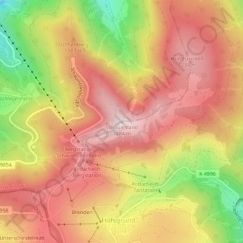
Nombre: Mapa topográfico Schauinsland, altitud, relieve.
Altitud media: 1,068 m
Altitud mínima: 740 m
Altitud máxima: 1,279 m