
Gracias por apoyar a este sitio ❤️
Haz una donación
Haz una donación
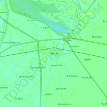
Mapa topográfico Makhu
Haga clic en el mapa para ver la altitud.
Gracias por apoyar a este sitio ❤️
Haz una donación
Haz una donación
Makhu
Makhu has an average elevation of 201 metres (659 feet). This town is located near the edge of Harike Sanctuary. It is 5 km away from the confluence of Satluj and Beas rivers.
Gracias por apoyar a este sitio ❤️
Haz una donación
Haz una donación
Acerca de este mapa
Nombre: Mapa topográfico Makhu, altitud, relieve.
Lugar: Makhu, Zira Tahsil, Firozpur, Punjab, 142044, India (31.06274 74.95041 31.14274 75.03041)
Altitud media: 210 m
Altitud mínima: 203 m
Altitud máxima: 222 m
Gracias por apoyar a este sitio ❤️
Haz una donación
Haz una donación