
Mapa topográfico Colorado Plateau
Mapa interactivo
Haga clic en el mapa para ver la altitud.
Acerca de este mapa
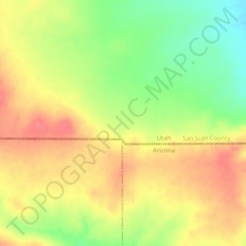
Nombre: Mapa topográfico Colorado Plateau, altitud, relieve.
Lugar: Colorado Plateau, San Juan County, Utah, United States (37.00023 -110.00101 37.00033 -110.00091)
Altitud media: 1,512 m
Altitud mínima: 1,474 m
Altitud máxima: 1,540 m
Younger igneous rocks form spectacular topographic features. The Henry Mountains, La Sal Range, and Abajo Mountains, ranges that dominate many views in southeastern Utah, are formed about igneous rocks that were intruded in the interval from 20 to 31 million years: some igneous intrusions in these mountains form laccoliths, a form of intrusion recognized by Grove Karl Gilbert during his studies of the Henry Mountains. Ship Rock (also called Shiprock), in northwestern New Mexico, and Church Rock and Agathla, near Monument Valley, are erosional remnants of potassium-rich igneous rocks and associated breccias of the Navajo Volcanic Field, produced about 25 million years ago. The Hopi Buttes in northeastern Arizona are held up by resistant sheets of sodic volcanic rocks, extruded about 7 million years ago. More recent igneous rocks are concentrated nearer the margins of the Colorado Plateau. The San Francisco Peaks near Flagstaff, south of the Grand Canyon, are volcanic landforms produced by igneous activity that began in that area about 6 million years ago and continued until 1064 CE, when basalt erupted in Sunset Crater National Monument. Mount Taylor, near Grants, New Mexico, is a volcanic structure with a history similar to that of the San Francisco Peaks: a basalt flow closer to Grants was extruded only about 3000 years ago (see El Malpais National Monument). These young igneous rocks may record processes in the Earth's mantle that are eating away at deep margins of the relatively stable block of the Plateau.
Otros mapas topográficos
Haga clic en un mapa para ver su topografía, su altitud y su relieve.
Upheaval Dome
United States > Utah > San Juan County
Upheaval Dome, San Juan County, Utah, United States
Altitud media: 1,627 m
Halchita
United States > Utah > San Juan County
Halchita, San Juan County, Utah, United States
Altitud media: 1,398 m
Aneth
United States > Utah > San Juan County
Aneth, Shiprock Agency, San Juan County, Utah, United States
Altitud media: 1,422 m
Monticello
United States > Utah > San Juan County
Monticello, San Juan County, Utah, United States
Altitud media: 2,145 m
La Sal
United States > Utah > San Juan County
La Sal, San Juan County, Utah, 84530, United States
Altitud media: 2,098 m
Lake Powell
United States > Utah > San Juan County
Lake Powell, San Juan County, Utah, United States
Altitud media: 1,555 m
Bluff
United States > Utah > San Juan County
Bluff, San Juan County, Utah, 84512, United States
Altitud media: 1,424 m