
Mapa topográfico Temple
Mapa interactivo
Haga clic en el mapa para ver la altitud.
Acerca de este mapa
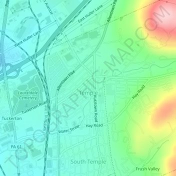
Nombre: Mapa topográfico Temple, altitud, relieve.
Altitud media: 126 m
Altitud mínima: 76 m
Altitud máxima: 274 m
Temple is a census-designated place in Muhlenberg Township, Berks County, Pennsylvania, United States at an elevation of 361 feet (110 m). The community was named for a local inn called Solomon's Temple. Temple was an independent borough until it was disincorporated on January 1, 1999. The ZIP code is 19560. As of the 2020 census the population was 2,073 residents.