
Mapa topográfico Hoshiarpur
Haga clic en el mapa para ver la altitud.
Hoshiarpur
Hoshiarpur has an average elevation of 296 metres (971 ft). Hoshiarpur district is located in the north-east part of the Indian state of Punjab. It falls in the Jalandhar Revenue Division and is situated in the Bist Doab portion of the Doaba region. Hoshiarpur shares a boundary with Kangra district, and Una district of Himachal Pradesh in the northeast. In the southwest, it borders Shahid Bhagat Singh Nagar district, Jalandhar district, and Kapurthala district, and in the northwest it borders Gurdaspur district.
Acerca de este mapa
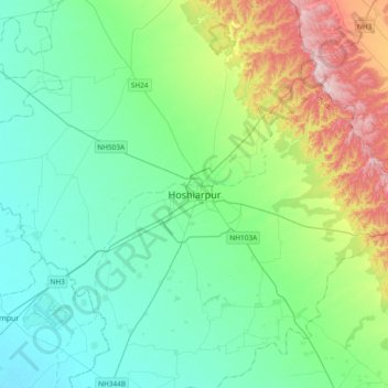
Nombre: Mapa topográfico Hoshiarpur, altitud, relieve.
Altitud media: 327 m
Altitud mínima: 239 m
Altitud máxima: 613 m