
Gracias por apoyar a este sitio ❤️
Haz una donación
Haz una donación
Mapa topográfico Hopland
Haga clic en el mapa para ver la altitud.
Gracias por apoyar a este sitio ❤️
Haz una donación
Haz una donación
Hopland
Hopland (formerly Sanel) is a census-designated place in Mendocino County, California, United States. It is located on the west bank of the Russian River 13 miles (21 km) south-southeast of Ukiah, in the Sanel Valley, at an elevation of 502 feet (153 m). The population was 661 at the 2020 census, down from 756 at the 2010 census.
Gracias por apoyar a este sitio ❤️
Haz una donación
Haz una donación
Acerca de este mapa
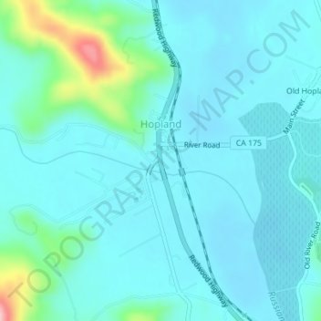
Nombre: Mapa topográfico Hopland, altitud, relieve.
Lugar: Hopland, Mendocino County, California, United States (38.96334 -123.12672 38.97641 -123.11028)
Altitud media: 165 m
Altitud mínima: 139 m
Altitud máxima: 314 m
Gracias por apoyar a este sitio ❤️
Haz una donación
Haz una donación