
Mapa topográfico St. Marys
Mapa interactivo
Haga clic en el mapa para ver la altitud.
Acerca de este mapa
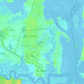
Nombre: Mapa topográfico St. Marys, altitud, relieve.
Lugar: St. Marys, Camden County, Georgia, United States (30.70904 -81.65818 30.84418 -81.50552)
Altitud media: 3 m
Altitud mínima: -7 m
Altitud máxima: 21 m
Otros mapas topográficos
Haga clic en un mapa para ver su topografía, su altitud y su relieve.
Cumberland Island National Seashore
United States > Georgia > Camden County > St. Marys
Cumberland Island National Seashore, St. Marys, Camden County, Georgia, United States
Altitud media: 1 m