
Gracias por apoyar a este sitio ❤️
Haz una donación
Haz una donación
Mapa topográfico Dellhofen
Haga clic en el mapa para ver la altitud.
Gracias por apoyar a este sitio ❤️
Haz una donación
Haz una donación
Dellhofen
Das Rheinhöhendorf Dellhofen ist ein Stadtteil und ein Ortsbezirk der Stadt Oberwesel im Rhein-Hunsrück-Kreis in Rheinland-Pfalz.
Gracias por apoyar a este sitio ❤️
Haz una donación
Haz una donación
Acerca de este mapa
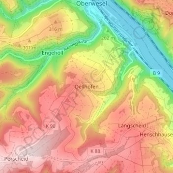
Nombre: Mapa topográfico Dellhofen, altitud, relieve.
Altitud media: 273 m
Altitud mínima: 71 m
Altitud máxima: 441 m
Gracias por apoyar a este sitio ❤️
Haz una donación
Haz una donación