Geolocalizar

Mapa topográfico Blackrock

Haga clic en el mapa para ver la altitud.

Acerca de este mapa

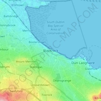
Nombre: Mapa topográfico Blackrock, altitud, relieve.

Lugar: Blackrock, Dún Laoghaire-Rathdown, County Dublin, Leinster, A94 VP03, Ireland (53.26186 -6.21883 53.34186 -6.13883)

Altitud media: 30 m

Altitud mínima: -2 m

Altitud máxima: 186 m

Otros mapas topográficos

Haga clic en un mapa para ver su topografía, su altitud y su relieve.

Dublin

Ireland > County Dublin

Altitud media: 42 m

Dublin

Ireland > County Dublin > Dublin

Altitud media: 23 m

Swords

Ireland > County Dublin

At the northern end of the street stands Swords Castle, 200m northeast of the ecclesiastical site, which was built in the early 13th century. A short distance north of the castle is the elevation known as Spittal Hill, where a hospital once stood.

Altitud media: 25 m

Middletown

Ireland > County Dublin

Altitud media: 39 m

Ballinteer

Ireland > County Dublin

Altitud media: 94 m

Dodder

Ireland > County Dublin > Ballyboden

Altitud media: 180 m

Lambay Island

Ireland > County Dublin

Lambay Island is the largest island off the east coast of Ireland. It covers about 2.5 km2 (0.97 sq mi). The highest point – a hill known as Knockbane – rises to 126 m (413 ft). The island's high ground lies to the east and aside from Knockbane includes Heath Hill and Tinian Hill, and in the extreme…

Altitud media: 14 m

St Anne's Park

Ireland > County Dublin > Dublin

Altitud media: 13 m

Dublin

Ireland > County Dublin

Altitud media: 42 m

Phoenix Park

Ireland > County Dublin > Dublin

Altitud media: 40 m

Baldoyle

Ireland > County Dublin > Sutton

A description of Baldoyle from Lewis's Topographical Dictionary of Ireland (Dublin, 1837) gives a useful summary of what was then a substantial rural fishing village.

Altitud media: 2 m

Rush

Ireland > County Dublin

Altitud media: 7 m

Rathmines

Ireland > County Dublin > Dublin

Altitud media: 28 m

Ballybrack

Ireland > County Dublin > Ballybrack

Altitud media: 32 m

Walkinstown

Ireland > County Dublin > Dublin

Altitud media: 49 m

Mountseskin

Ireland > County Dublin

Altitud media: 312 m

Dublin (Finglas)

Ireland > County Dublin > Dublin

Altitud media: 48 m

Burgage

Ireland > County Dublin > Kinsealey

Altitud media: 34 m

Milltown

Ireland > County Dublin > Dublin

Altitud media: 27 m

Donabate Beach

Ireland > County Dublin

Altitud media: 2 m

Donnycarney

Ireland > County Dublin > Dublin

Altitud media: 24 m

Dublin

Ireland > County Dublin

Altitud media: 42 m

Jamestown

Ireland > County Dublin > Dublin

Altitud media: 37 m

Corkagh Park

Ireland > County Dublin > Clondalkin

Altitud media: 80 m

Corballis

Ireland > County Dublin

Altitud media: 56 m

Portraine

Ireland > County Dublin

Altitud media: 4 m

Corballis

Ireland > County Dublin

Altitud media: 56 m

Malahide

Ireland > County Dublin

Altitud media: 10 m

Dublin

Ireland > County Dublin

Altitud media: 42 m

South Dublin

Ireland > County Dublin

Altitud media: 183 m

Dublin (Cabra)

Ireland > County Dublin > Dublin

Altitud media: 37 m

Shanganagh

Ireland > County Dublin > Shankill

Altitud media: 20 m

Hollystown

Ireland > County Dublin

Altitud media: 75 m

Griffith Park

Ireland > County Dublin > Dublin

Altitud media: 26 m

Piperstown

Ireland > County Dublin

Altitud media: 297 m

Inchicore South

Ireland > County Dublin > Dublin

Altitud media: 31 m

Dublin

Ireland > County Dublin

Altitud media: 42 m

Ballyboughal

Ireland > County Dublin

Altitud media: 35 m

Cherryhound

Ireland > County Dublin

Altitud media: 79 m

Milltown

Ireland > County Dublin > Dublin

Altitud media: 27 m

Lambay Island

Ireland > County Dublin

Lambay Island is the largest island off the east coast of Ireland. It covers about 2.5 km2 (0.97 sq mi). The highest point – a hill known as Knockbane – rises to 126 m (413 ft). The island's high ground lies to the east and aside from Knockbane includes Heath Hill and Tinian Hill, and in the extreme…

Altitud media: 14 m

Dublin

Ireland > County Dublin

Altitud media: 42 m

Dublin

Ireland > County Dublin

Altitud media: 42 m

Donabate Beach

Ireland > County Dublin

Altitud media: 2 m

Swords

Ireland > County Dublin

At the northern end of the street stands Swords Castle, 200m northeast of the ecclesiastical site, which was built in the early 13th century. A short distance north of the castle is the elevation known as Spittal Hill, where a hospital once stood.

Altitud media: 25 m

Portmarnock

Ireland > County Dublin

Altitud media: 6 m

Brittas

Ireland > County Dublin

Altitud media: 250 m

Warblestown

Ireland > County Dublin

Altitud media: 32 m

Fingal

Ireland > County Dublin

Altitud media: 39 m

Marlay Park

Ireland > County Dublin > Ballyboden

Altitud media: 109 m

Iveagh Gardens

Ireland > County Dublin > Dublin

Altitud media: 17 m

Kilcarbery Park

Ireland > County Dublin

Altitud media: 73 m

Rathfarnham

Ireland > County Dublin > Rathfarnham

Altitud media: 57 m

Kiltiernan

Ireland > County Dublin

Altitud media: 179 m

Swords

Ireland > County Dublin

At the northern end of the street stands Swords Castle, 200m northeast of the ecclesiastical site, which was built in the early 13th century. A short distance north of the castle is the elevation known as Spittal Hill, where a hospital once stood.

Altitud media: 25 m

Fingal

Ireland > County Dublin

Altitud media: 39 m

Warblestown

Ireland > County Dublin

Altitud media: 32 m

Damastown

Ireland > County Dublin

Altitud media: 95 m

South Dublin

Ireland > County Dublin

Altitud media: 183 m

Redgap

Ireland > County Dublin

Altitud media: 205 m

Drimnagh Castle

Ireland > County Dublin > Dublin

By the mid-19th century, the castle was owned by the then Marquess of Lansdowne, with Samuel Lewis's Topographical Dictionary of Ireland (printed 1837) stating that it was an "irregular pile", the "property of the Marquess of Lansdowne [..] occupied by Mr. E. Cavanagh".

Altitud media: 45 m

Kilgobbin

Ireland > County Dublin > Stepaside

Altitud media: 143 m

Glasnevin

Ireland > County Dublin > Dublin

Altitud media: 33 m

Malahide

Ireland > County Dublin

Altitud media: 10 m

Malahide

Ireland > County Dublin

Altitud media: 10 m

Rush

Ireland > County Dublin

Altitud media: 7 m

Lusk

Ireland > County Dublin

Altitud media: 23 m

Yellowmeadows

Ireland > County Dublin

Altitud media: 59 m

Clondalkin

Ireland > County Dublin > Clondalkin

Altitud media: 73 m

Ballyboughal

Ireland > County Dublin

Altitud media: 35 m

Priorswood

Ireland > County Dublin > Dublin

Altitud media: 42 m

Rowans Little

Ireland > County Dublin

Altitud media: 58 m

Drimnagh Castle

Ireland > County Dublin > Dublin

By the mid-19th century, the castle was owned by the then Marquess of Lansdowne, with Samuel Lewis's Topographical Dictionary of Ireland (printed 1837) stating that it was an "irregular pile", the "property of the Marquess of Lansdowne [..] occupied by Mr. E. Cavanagh".

Altitud media: 45 m

Sandymount

Ireland > County Dublin > Dublin

Altitud media: 5 m

Balbriggan

Ireland > County Dublin

Altitud media: 22 m

Huntstown

Ireland > County Dublin

Altitud media: 67 m

Swords

Ireland > County Dublin

At the northern end of the street stands Swords Castle, 200m northeast of the ecclesiastical site, which was built in the early 13th century. A short distance north of the castle is the elevation known as Spittal Hill, where a hospital once stood.

Altitud media: 25 m

Swords

Ireland > County Dublin

At the northern end of the street stands Swords Castle, 200m northeast of the ecclesiastical site, which was built in the early 13th century. A short distance north of the castle is the elevation known as Spittal Hill, where a hospital once stood.

Altitud media: 24 m