
Mapa topográfico Cherrapunji (Sohra)
Mapa interactivo
Haga clic en el mapa para ver la altitud.
Acerca de este mapa
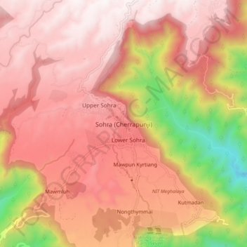
Nombre: Mapa topográfico Cherrapunji (Sohra), altitud, relieve.
Altitud media: 1,248 m
Altitud mínima: 332 m
Altitud máxima: 1,677 m
It has an average elevation of 1,430 metres (4,690 ft) and sits on a plateau in the southern part of the Khasi Hills, facing the plains of Bangladesh. The plateau rises 660 meters above the surrounding valleys.