
Mapa topográfico Irelands Eye
Mapa interactivo
Haga clic en el mapa para ver la altitud.
Acerca de este mapa
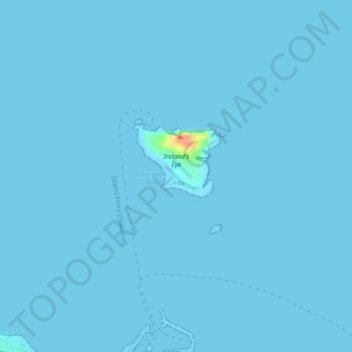
Nombre: Mapa topográfico Irelands Eye, altitud, relieve.
Altitud media: 0 m
Altitud mínima: -5 m
Altitud máxima: 43 m
Otros mapas topográficos
Haga clic en un mapa para ver su topografía, su altitud y su relieve.
Ireland's Eye
Ireland's Eye, Howth ED, Howth, Fingal, County Dublin, Leinster, Ireland
Altitud media: 0 m