
Mapa topográfico Alandi
Haga clic en el mapa para ver la altitud.
Alandi
Alandi (18°40′37.42″N 73°53′47.76″E / 18.6770611°N 73.8966000°E / 18.6770611; 73.8966000) is located on the bank of the Indrayani River, 18.8 km (11.7 mi) from Khed Taluka of Pune District, near the northern edge of the city of Pune. Alandi has an average elevation of 577 meters (1,893 feet).
Acerca de este mapa
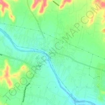
Nombre: Mapa topográfico Alandi, altitud, relieve.
Lugar: Alandi, Khed, Pune District, Maharashtra, 412105, India (18.65724 73.87811 18.69724 73.91811)
Altitud media: 578 m
Altitud mínima: 552 m
Altitud máxima: 631 m
Otros mapas topográficos
Haga clic en un mapa para ver su topografía, su altitud y su relieve.