
Gracias por apoyar a este sitio ❤️
Haz una donación
Haz una donación
Mapa topográfico Crataloe East
Haga clic en el mapa para ver la altitud.
Gracias por apoyar a este sitio ❤️
Haz una donación
Haz una donación
Acerca de este mapa
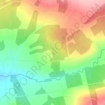
Nombre: Mapa topográfico Crataloe East, altitud, relieve.
Altitud media: 184 m
Altitud mínima: 112 m
Altitud máxima: 264 m
Gracias por apoyar a este sitio ❤️
Haz una donación
Haz una donación
Otros mapas topográficos
Haga clic en un mapa para ver su topografía, su altitud y su relieve.
Knockawarriga
Ireland > County Limerick > The Municipal District of Newcastle West
Altitud media: 247 m
Templeglantine
Ireland > County Limerick > The Municipal District of Newcastle West
Altitud media: 189 m