
Mapa topográfico Cañon City
Mapa interactivo
Haga clic en el mapa para ver la altitud.
Cañon City
The city's nickname, "the Climate Capital of Colorado", derives from the combination of unique geography and 5,300-foot (1,600 m) elevation protecting the city from harsh weather conditions. The average daily high temperature in January is 14 °F (7.8 °C) warmer in Cañon City than in Grand Junction, even though the elevation of Cañon City is higher.
Acerca de este mapa
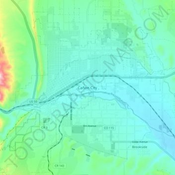
Nombre: Mapa topográfico Cañon City, altitud, relieve.
Lugar: Cañon City, Fremont County, Colorado, 81212, United States (38.40236 -105.26249 38.48236 -105.18249)
Altitud media: 1,670 m
Altitud mínima: 1,589 m
Altitud máxima: 2,045 m