
Gracias por apoyar a este sitio ❤️
Haz una donación
Haz una donación
Mapa topográfico Sagwara
Haga clic en el mapa para ver la altitud.
Gracias por apoyar a este sitio ❤️
Haz una donación
Haz una donación
Sagwara
Sagwara is located in the east-central Dungarpur district, in Sagwara Tehsil. It has an average elevation of 244 metres (801 ft). Sagwara is famous for its sculpture, marble carving, temple architecture and gold jewelry. It is a major trading hub for nearby villages.
Gracias por apoyar a este sitio ❤️
Haz una donación
Haz una donación
Acerca de este mapa
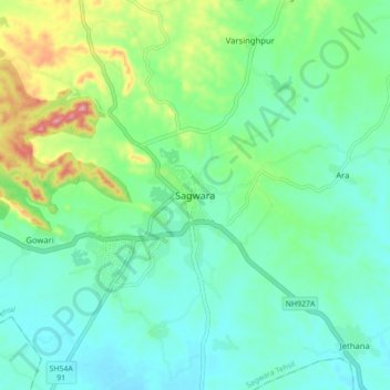
Nombre: Mapa topográfico Sagwara, altitud, relieve.
Altitud media: 177 m
Altitud mínima: 138 m
Altitud máxima: 291 m
Gracias por apoyar a este sitio ❤️
Haz una donación
Haz una donación