
Gracias por apoyar a este sitio ❤️
Haz una donación
Haz una donación
Mapa topográfico Sellnrod
Haga clic en el mapa para ver la altitud.
Gracias por apoyar a este sitio ❤️
Haz una donación
Haz una donación
Sellnrod
Die Statistisch-topographisch-historische Beschreibung des Großherzogthums Hessen berichtet 1830 über Sellnrod.
Gracias por apoyar a este sitio ❤️
Haz una donación
Haz una donación
Acerca de este mapa
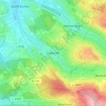
Nombre: Mapa topográfico Sellnrod, altitud, relieve.
Lugar: Sellnrod, Mücke, Vogelsbergkreis, Hessen, Deutschland (50.56153 9.07538 50.60153 9.11538)
Altitud media: 358 m
Altitud mínima: 282 m
Altitud máxima: 503 m
Gracias por apoyar a este sitio ❤️
Haz una donación
Haz una donación