
Mapa topográfico Still Pond
Mapa interactivo
Haga clic en el mapa para ver la altitud.
Acerca de este mapa
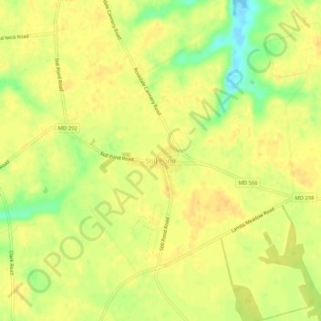
Nombre: Mapa topográfico Still Pond, altitud, relieve.
Lugar: Still Pond, Kent County, Maryland, 21667, United States (39.30787 -76.06532 39.34787 -76.02532)
Altitud media: 21 m
Altitud mínima: -3 m
Altitud máxima: 29 m
Otros mapas topográficos
Haga clic en un mapa para ver su topografía, su altitud y su relieve.
Golts
United States > Maryland > Kent County
Golts, Kent County, Maryland, United States
Altitud media: 22 m
Langford Bay Estates
United States > Maryland > Kent County
Langford Bay Estates, Kent County, Maryland, United States
Altitud media: 4 m