
Gracias por apoyar a este sitio ❤️
Haz una donación
Haz una donación
Mapa topográfico Bathinda
Haga clic en el mapa para ver la altitud.
Gracias por apoyar a este sitio ❤️
Haz una donación
Haz una donación
Bathinda
Bathinda is in the northwestern region of India and is a part of the Indo-Gangetic alluvial plains. The exact cartographic co-ordinates of Bathinda are 30°12′N 74°57′E / 30.20°N 74.95°E / 30.20; 74.95. It has an average elevation of 201 metres (660 ft).
Gracias por apoyar a este sitio ❤️
Haz una donación
Haz una donación
Acerca de este mapa
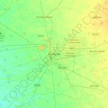
Nombre: Mapa topográfico Bathinda, altitud, relieve.
Lugar: Bathinda, Bathinda Tahsil, Bathinda, Punjab, 151001, India (30.04679 74.78637 30.36679 75.10637)
Altitud media: 208 m
Altitud mínima: 199 m
Altitud máxima: 218 m
Gracias por apoyar a este sitio ❤️
Haz una donación
Haz una donación