
Mapa topográfico Reuterwanne
Mapa interactivo
Haga clic en el mapa para ver la altitud.
Acerca de este mapa
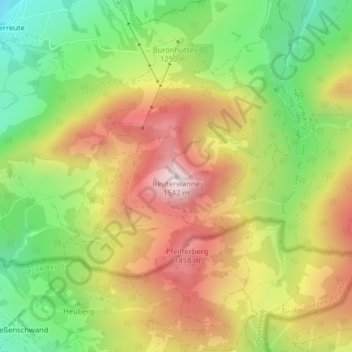
Nombre: Mapa topográfico Reuterwanne, altitud, relieve.
Altitud media: 1,214 m
Altitud mínima: 916 m
Altitud máxima: 1,530 m
Otros mapas topográficos
Haga clic en un mapa para ver su topografía, su altitud y su relieve.
Enthalb der Ach
Deutschland > Bayern > Landkreis Oberallgäu > Wertach > Enthalb der Ach
Enthalb der Ach, Wertach, Landkreis Oberallgäu, Bayern, 87497, Deutschland
Altitud media: 984 m