
Gracias por apoyar a este sitio ❤️
Haz una donación
Haz una donación
Mapa topográfico Itaba
Haga clic en el mapa para ver la altitud.
Gracias por apoyar a este sitio ❤️
Haz una donación
Haz una donación
Itaba
The climate is tropical, and is moderated by altitude. Under normal conditions, the dry season is from three to four months from June to September. In general, the climate is mild with regular and abundant rainfall. The annual average temperature is 19.7 °C (average maximum 25.5 °C, minimum average 13.8 °C). Generally, temperatures do not experience significant changes in year.
Gracias por apoyar a este sitio ❤️
Haz una donación
Haz una donación
Acerca de este mapa
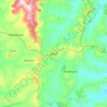
Nombre: Mapa topográfico Itaba, altitud, relieve.
Lugar: Itaba, Gitega, Burundi (-3.65642 29.98736 -3.57642 30.06736)
Altitud media: 1,735 m
Altitud mínima: 1,589 m
Altitud máxima: 2,050 m
Gracias por apoyar a este sitio ❤️
Haz una donación
Haz una donación