
Gracias por apoyar a este sitio ❤️
Haz una donación
Haz una donación
Mapa topográfico Cerro Cabuya
Haga clic en el mapa para ver la altitud.
Gracias por apoyar a este sitio ❤️
Haz una donación
Haz una donación
Acerca de este mapa
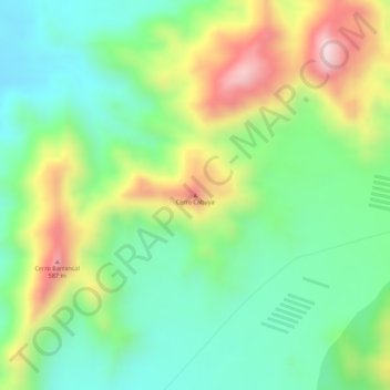
Nombre: Mapa topográfico Cerro Cabuya, altitud, relieve.
Lugar: Cerro Cabuya, Huaral, Lima, Perú (-11.37433 -77.26286 -11.37423 -77.26276)
Altitud media: 429 m
Altitud mínima: 293 m
Altitud máxima: 637 m
Gracias por apoyar a este sitio ❤️
Haz una donación
Haz una donación
Otros mapas topográficos
Haga clic en un mapa para ver su topografía, su altitud y su relieve.