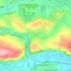
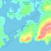
Mapa topográfico Great Island
Haga clic en el mapa para ver la altitud.
Great Island
In the 19th century Topographical Dictionary of Ireland (published by Samuel Lewis in 1837), Great Island is described as "very fertile" with its "light productive soil" supporting agricultural uses with "two-thirds [of the island] under tillage, and the remainder in pasture or included in demesnes". Lewis describes the island's location, environment and climate as factors "induc[ing] many genteel families to settle here".
Acerca de este mapa

Nombre: Mapa topográfico Great Island, altitud, relieve.
Altitud media: 20 m
Altitud mínima: -12 m
Altitud máxima: 95 m
Otros mapas topográficos
Haga clic en un mapa para ver su topografía, su altitud y su relieve.





















Watergrasshill
According to A Topographical Dictionary of Ireland, published by Samuel Lewis in 1837, Watergrasshill then had a population of 533 people.
Altitud media: 164 m