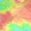
Mapa topográfico Montauroux
Haga clic en el mapa para ver la altitud.
Montauroux
Montauroux is situated in the east of the Var and at the border of the Alpes-Maritimes. Montauroux rises in tiers of altitudes from 150 m to 400 m. The village has a southern exposure, facing the Esterel massif and the St Cassien Lake. Montauroux is located midway between the sea which is 30 km (19 mi) away and the first ski resort which is 40 km (25 mi), away. Montauroux benefits from an exceptional amount of sunny days and is visited by tourists in the summer months, many hotels are often fully booked for the summer by mid-April or earlier.
Acerca de este mapa
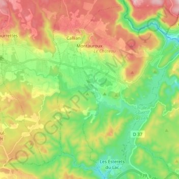
Nombre: Mapa topográfico Montauroux, altitud, relieve.
Altitud media: 259 m
Altitud mínima: 81 m
Altitud máxima: 518 m
Otros mapas topográficos
Haga clic en un mapa para ver su topografía, su altitud y su relieve.

Les Mas de Guerrevieille
France > Provence-Alpes-Côte d'Azur > Var > Sainte-Maxime
Altitud media: 60 m



Ruines du Barrage de Malpasset
France > Provence-Alpes-Côte d'Azur > Var > Fréjus
Altitud media: 118 m