

Mapa topográfico Ranebennur
Haga clic en el mapa para ver la altitud.
Ranebennur
Ranebennuru is at the geographical center of Karnataka. 14°37′N 75°37′E / 14.62°N 75.62°E / 14.62; 75.62.[2] It has an average elevation of 605 metres (1,985 ft). One of Karnataka's most important rivers – the Tungabhadra – flows along the southern border of Ranebennur taluk. Another river, the Kumadvathi, which originates from Madagh Masur Lake[3] flows from Hirekerur taluk, enters Ranebennur taluk, and joins the Tungabhadra river.
Acerca de este mapa
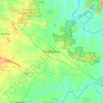
Nombre: Mapa topográfico Ranebennur, altitud, relieve.
Altitud media: 574 m
Altitud mínima: 509 m
Altitud máxima: 785 m