
Mapa topográfico Mirik
Haga clic en el mapa para ver la altitud.
Mirik
Mirik has an average elevation of 1,495 m (4,905 ft). The highest point is the Bokar Monastery at about 1,768 m (5,801 ft). Mirik lake at about 1,494 m (4,902 ft) is the lowest point. Mirik is 52 km (32 mi) northwest of Siliguri city and 49 km (30 mi) south-southwest of Darjeeling town. Mirik subdivision. The name Mirik comes from the Lepcha words Mir-Yok meaning "place burnt by fire".
Acerca de este mapa
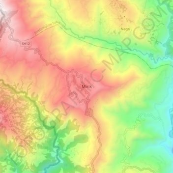
Nombre: Mapa topográfico Mirik, altitud, relieve.
Altitud media: 1,156 m
Altitud mínima: 401 m
Altitud máxima: 1,949 m