
Gracias por apoyar a este sitio ❤️
Haz una donación
Haz una donación
Mapa topográfico Keren
Haga clic en el mapa para ver la altitud.
Gracias por apoyar a este sitio ❤️
Haz una donación
Haz una donación
Keren
Keren (Tigrinya and Tigre: ከረን, Arabic: كرن, Italian: Cheren), historically known as Sanhit, is the second-largest city in Eritrea. It is situated around 91 kilometres (57 mi) northwest of Asmara at an elevation of 1,590 metres (5,220 ft) above sea-level. The city sprawls on a wide basin surrounded by granitic mountains on all sides. It serves as the capital of the Anseba Region, and is home to a number of ethnic groups including the Bilen people and Tigre people.
Gracias por apoyar a este sitio ❤️
Haz una donación
Haz una donación
Acerca de este mapa
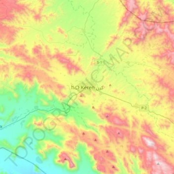
Nombre: Mapa topográfico Keren, altitud, relieve.
Lugar: Keren, Anseba, Eritrea (15.62048 38.29361 15.94048 38.61361)
Altitud media: 1,456 m
Altitud mínima: 811 m
Altitud máxima: 2,359 m
Gracias por apoyar a este sitio ❤️
Haz una donación
Haz una donación