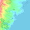
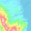
Mapa topográfico Limasawa
Haga clic en el mapa para ver la altitud.
Limasawa
Limasawa was the second island (after Suluan) of the Philippines that the Magellan Expedition landed on. Antonio Pigafetta documented the island as "Mazaua". He described it as being inhabited with cultivated fields. In March 28, 1521 the Magellan Expedition met with two rulers, Rajah Colambu and Rahah Siaui, of the Rajahnate of Butuan and "Calagan" (Caraga), which Pigafetta misidentified as islands. The rulers were on a hunting expedition on Limasawa (which were under their domain) with two balangay ships. The rulers entertained Magellan's crew with feasting for a few days. Afterwards, Father Pedro de Valderrama performed the first mass in the Philippines on Easter Sunday (March 31, 1521). Magellan also climbed the highest elevation in Limasawa and erected a cross before leaving for "Zubu" (Cebu).
Acerca de este mapa

Nombre: Mapa topográfico Limasawa, altitud, relieve.
Lugar: Limasawa, Southern Leyte, Eastern Visayas, 6618, Philippines (9.76033 124.93048 10.01901 125.17560)
Altitud media: 1 m
Altitud mínima: 0 m
Altitud máxima: 211 m
Otros mapas topográficos
Haga clic en un mapa para ver su topografía, su altitud y su relieve.


Mount Cabalian
The stratovolcano has an elevation of 945 metres (3,100 ft) with a base diameter of 8.5 kilometres (5.3 mi). The predominant rock type is andesite. Beside solfataras, other thermal features present are hot springs located on the east and west flank of the volcano. Mainit Hot Spring in the municipality of…
Altitud media: 524 m




Hinunangan
Hinunangan is home to the highest mountain in the province, Mount Nacolod, with an elevation of 948 metres (3,110 ft) above sea level.
Altitud media: 35 m



Sogod
On May 18, 1700, the colonial government of the Philippines established Sogod as a regular visita [satellite barrio with chapel]. With this elevation, a concrete church finally stood in the settlement in the year 1718. The construction was made possible through the mandate of the Most Reverend Sebastian…
Altitud media: 94 m



Mount Cabalian
The stratovolcano has an elevation of 945 metres (3,100 ft) with a base diameter of 8.5 kilometres (5.3 mi). The predominant rock type is andesite. Beside solfataras, other thermal features present are hot springs located on the east and west flank of the volcano. Mainit Hot Spring in the municipality of…
Altitud media: 524 m
Hinunangan
Hinunangan is home to the highest mountain in the province, Mount Nacolod, with an elevation of 948 metres (3,110 ft) above sea level.
Altitud media: 35 m
Sogod
On May 18, 1700, the colonial government of the Philippines established Sogod as a regular visita [satellite barrio with chapel]. With this elevation, a concrete church finally stood in the settlement in the year 1718. The construction was made possible through the mandate of the Most Reverend Sebastian…
Altitud media: 94 m