
Mapa topográfico Checotah
Mapa interactivo
Haga clic en el mapa para ver la altitud.
Checotah
Checotah is located at an elevation of 652 feet (199 m) at the intersection of I-40 and U.S. Route 69. Nearby is Eufaula Lake, the largest-capacity lake wholly within the state of Oklahoma.
Acerca de este mapa
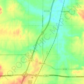
Nombre: Mapa topográfico Checotah, altitud, relieve.
Lugar: Checotah, McIntosh County, Oklahoma, 74426, United States (35.44943 -95.54899 35.53302 -95.50439)
Altitud media: 189 m
Altitud mínima: 168 m
Altitud máxima: 216 m
Otros mapas topográficos
Haga clic en un mapa para ver su topografía, su altitud y su relieve.
Honey Springs Battlefield
United States > Oklahoma > McIntosh County > Rentiesville
Altitud media: 185 m