
Mapa topográfico Don Carlos
Mapa interactivo
Haga clic en el mapa para ver la altitud.
Acerca de este mapa
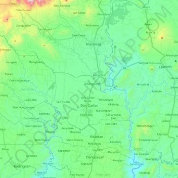
Nombre: Mapa topográfico Don Carlos, altitud, relieve.
Lugar: Don Carlos, Bukidnon, Northern Mindanao, Philippines (7.62837 124.81783 7.77481 125.05472)
Altitud media: 330 m
Altitud mínima: 106 m
Altitud máxima: 1,138 m
The terrain of the municipality of Don Carlos is generally flat except the mountain range on the eastern part of the municipality. The highest elevation is 700 metres (2,300 ft) above sea level and the lowest elevation is 300 metres (980 ft) below sea level.