

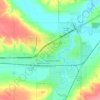
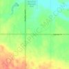
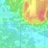
Mapa topográfico Unity
Haga clic en el mapa para ver la altitud.
Acerca de este mapa

Nombre: Mapa topográfico Unity, altitud, relieve.
Lugar: Unity, Saskatchewan, S0K 4L0, Canada (52.42746 -109.19347 52.45630 -109.13357)
Altitud media: 640 m
Altitud mínima: 615 m
Altitud máxima: 656 m
Otros mapas topográficos
Haga clic en un mapa para ver su topografía, su altitud y su relieve.













Buffalo Pound Provincial Park
Canada > Saskatchewan > Marquis No. 191
Nicolle Flats Marsh, with a total area of 73.18 km2 (28.25 sq mi) and an elevation of 511 m (1,677 ft), is a large marshy area located in the park at the south-east corner of Buffalo Pound Lake. The confluence of the Qu'Appelle and Moose Jaw Rivers is in the marsh. The area is an Important Bird Area of Canada…
Altitud media: 572 m



McClean Lake
Canada > Saskatchewan > Division No. 18 > Unorganized Division No. 18
Altitud media: 440 m












La Loche
Canada > Saskatchewan > Northern Saskatchewan Administration District > La Loche
Altitud media: 447 m




Pelican Narrows
Canada > Saskatchewan > Northern Saskatchewan Administration District > Pelican Narrows
Altitud media: 321 m