
Mapa topográfico Chilson
Haga clic en el mapa para ver la altitud.
Acerca de este mapa
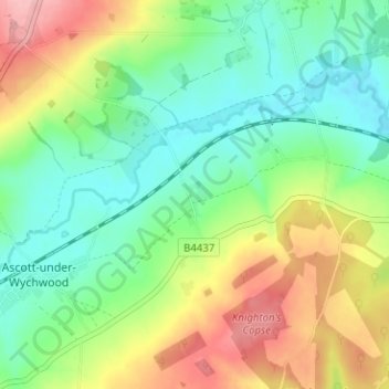
Nombre: Mapa topográfico Chilson, altitud, relieve.
Altitud media: 132 m
Altitud mínima: 85 m
Altitud máxima: 210 m
Otros mapas topográficos
Haga clic en un mapa para ver su topografía, su altitud y su relieve.
Ledwell
United Kingdom > England > Oxfordshire > West Oxfordshire > Sandford St. Martin
Altitud media: 142 m
Great Park
United Kingdom > England > Oxfordshire > West Oxfordshire > Long Hanborough
Altitud media: 94 m
Upper Milton
United Kingdom > England > Oxfordshire > West Oxfordshire > Milton-under-Wychwood
Altitud media: 153 m