
Gracias por apoyar a este sitio ❤️
Haz una donación
Haz una donación
Mapa topográfico Frontenac Provincial Park
Haga clic en el mapa para ver la altitud.
Gracias por apoyar a este sitio ❤️
Haz una donación
Haz una donación
Frontenac Provincial Park
Frontenac Provincial Park is located near the town of Sydenham, north of the city of Kingston, Ontario, Canada. The Government of Ontario has classified Frontenac Provincial Park as a natural environment park. The park lies on the Frontenac Axis, a topographic extension of the Canadian Shield, which connects to the Adirondack Mountains, and consists of mixed forest, lakes, wetlands, and granite outcrops. Recreational opportunities include hiking, canoeing, and backcountry camping. Wilderness courses are offered to teach wilderness skills in a semi-wilderness setting.
Gracias por apoyar a este sitio ❤️
Haz una donación
Haz una donación
Acerca de este mapa
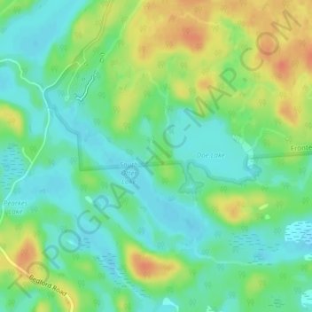
Nombre: Mapa topográfico Frontenac Provincial Park, altitud, relieve.
Altitud media: 151 m
Altitud mínima: 134 m
Altitud máxima: 178 m
Gracias por apoyar a este sitio ❤️
Haz una donación
Haz una donación