
Mapa topográfico Point Peron (S3)
Haga clic en el mapa para ver la altitud.
Acerca de este mapa
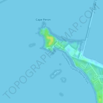
Nombre: Mapa topográfico Point Peron (S3), altitud, relieve.
Altitud media: 1 m
Altitud mínima: -3 m
Altitud máxima: 19 m
Otros mapas topográficos
Haga clic en un mapa para ver su topografía, su altitud y su relieve.
Perth
Perth, the capital of Western Australia, is situated on the Swan Coastal Plain, a flat expanse of sandy soil nestled between the Indian Ocean to the west and the Darling Scarp to the east. The Darling Scarp, also known as the Darling Range, is a low escarpment that extends north–south, marking a distinct…
Altitud media: 26 m
Rockingham
Australia > Western Australia > Rockingham
Rockingham is topographically flat, has sandy soils and coastal vegetation. It has a northern aspect to Cockburn Sound, from Rockingham Beach and Palm Beach.
Altitud media: 4 m
Wembley
The Indigenous people of the land are the Mooro, a subgroup of the Whadjuk, of the Noongar Aboriginal clan inhabiting the upper west region of the Swan River for at least 40,000 years. The Mooro used resources throughout the region north of the Swan River and moved as the seasons changed. They moved towards…
Altitud media: 19 m
Mount Meharry
The summit of Mount Meharry can be reached from the Great Northern Highway via an unsealed road 16 kilometres (9.9 mi) in length and a vehicular track 21 kilometres (13 mi) in length. Permission should be sought from the managers of the land over which the road and track pass. These are Juna Downs Station and…
Altitud media: 1,030 m