
Mapa topográfico Brookings County
Mapa interactivo
Haga clic en el mapa para ver la altitud.
Brookings County
Brookings County is on the east side of South Dakota. Its east boundary line abuts the west boundary line of the state of Minnesota. The Big Sioux River flows south-southeastward through the east central part of the county; its point of entry into Moody County marks Brookings County's lowest elevation: 1,568' (478m) ASL.
Acerca de este mapa
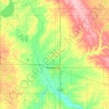
Nombre: Mapa topográfico Brookings County, altitud, relieve.
Lugar: Brookings County, South Dakota, United States (44.19593 -97.12974 44.54378 -96.45182)
Altitud media: 525 m
Altitud mínima: 472 m
Altitud máxima: 617 m