
Mapa topográfico Hume Lake
Mapa interactivo
Haga clic en el mapa para ver la altitud.
Acerca de este mapa
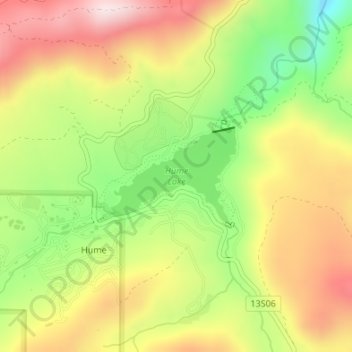
Nombre: Mapa topográfico Hume Lake, altitud, relieve.
Lugar: Hume Lake, Hume, Fresno County, California, United States (36.78691 -118.91295 36.79437 -118.90006)
Altitud media: 1,661 m
Altitud mínima: 1,427 m
Altitud máxima: 1,887 m
The surface elevation of the lake is 1,586.34 m (5,204.5 ft). It is accessible from California Route 180, via Forest Service road 30, and is about 51 mi (82 km) east of Fresno, not far from the west entrance to Kings Canyon National Park.