
Mapa topográfico Nunavik
Haga clic en el mapa para ver la altitud.
Acerca de este mapa
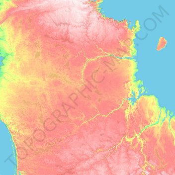
Nombre: Mapa topográfico Nunavik, altitud, relieve.
Lugar: Nunavik, Canada (56.42813 -75.03416 61.62813 -69.83416)
Altitud media: 191 m
Altitud mínima: -1 m
Altitud máxima: 632 m
Otros mapas topográficos
Haga clic en un mapa para ver su topografía, su altitud y su relieve.
Ontario
Ontario's topography is a diverse tapestry shaped by its vast expanse and geological history. The Canadian Shield dominates the northern and central regions, characterized by ancient Precambrian rock formations, rugged terrain, and numerous lakes and rivers. In contrast, the Hudson Bay Lowlands in the far…
Altitud media: 245 m
Edmonton
Edmonton is on the North Saskatchewan River, at an elevation of 671 m (2,201 ft). It is North America's northernmost city with a metropolitan population over one million. It is at the same latitude as Hamburg (Germany); Dublin (Ireland); Manchester (United Kingdom); and Magnitogorsk (Russia). It is south of…
Altitud media: 690 m
Vancouver
Canada > British Columbia > Metro Vancouver Regional District
Vancouver, British Columbia, is situated on the Burrard Peninsula, bordered by Burrard Inlet to the north and the Fraser River to the south. The city's topography is a blend of flat and hilly terrains, with elevations ranging from sea level to approximately 152 meters (500 feet) above sea level. The North…
Altitud media: 34 m
British Columbia
British Columbia's topography is a testament to its diverse and dramatic landscapes. Dominated by the Cordillera region, the province features prominent mountain ranges such as the Coast Mountains in the west and the Rocky Mountains in the east. The Coast Mountains, composed of granite rocks from the…
Altitud media: 708 m
Nova Scotia
Nova Scotia's topography is a diverse blend of rugged highlands, rolling hills, and fertile lowlands. The province's landscape is shaped by several upland regions, including the Southern Upland, North Mountain, and Cobequid Mountain, which are interspersed with extensive lowlands. The Southern Upland rises…
Altitud media: 41 m
Calgary
Calgary, Alberta, is uniquely positioned in the transition zone between the rolling Canadian Prairies to the east and the rugged foothills of the Canadian Rockies to the west, creating a landscape of undulating hills, plateau-like uplands, and deep river valleys. The Bow and Elbow Rivers carve prominent bluffs…
Altitud media: 1,106 m
Ottawa
Ottawa, the capital city of Canada, is situated on the south bank of the Ottawa River at the confluence with the Rideau River. The city's topography is characterized by gently rolling terrain with elevations ranging from approximately 44 meters (144 feet) above sea level at the Ottawa River to its highest…
Altitud media: 105 m
Quebec
Quebec's topography is characterized by three main physiographic regions: the Canadian Shield, the St. Lawrence Lowlands, and the Appalachian Mountains. The Canadian Shield, covering about 90% of the province, features rugged terrain with rocky plateaus, rolling hills, and numerous rivers and lakes formed by…
Altitud media: 195 m
Victoria
Canada > British Columbia > Capital Regional District
Victoria, British Columbia, is situated on the southern tip of Vancouver Island, Canada, and boasts a diverse and varied topography. The city is characterized by rolling hills, rugged coastal cliffs, and lush valleys, providing a striking contrast between mountainous terrain and flatland areas. To the north…
Altitud media: 17 m
Halifax
Canada > Nova Scotia > Halifax County
The coastline is heavily indented, accounting for its length of approximately 400 km (250 mi), with the northern boundary of the municipality usually being between 50–60 km (31–37 mi) inland. The coast is mostly rock with small isolated sand beaches in sheltered bays. The largest coastal features include…
Altitud media: 46 m
Newfoundland and Labrador
In 1496, John Cabot obtained a charter from English King Henry VII to "sail to all parts, countries and seas of the East, the West and of the North, under our banner and ensign and to set up our banner on any new-found-land" and on June 24, 1497, landed in Cape Bonavista. Historians disagree on whether Cabot…
Altitud media: 192 m
Kelowna
Canada > British Columbia > Regional District of Central Okanagan
Kelowna is classified as a humid continental climate or an inland oceanic climate per the Köppen climate classification system due to its coldest month having an average temperature slightly above −3.0 °C (26.6 °F) and below 0 °C (32 °F), with dry, hot, sunny summers and cool, cloudy winters, and four…
Altitud media: 704 m
St. Catharines
Canada > Ontario > Niagara Region
The most defining transportation icon of St. Catharines is the Welland Canal, a ship canal that runs 43.4 kilometres (27.0 mi), passing through the city. Four of its locks are within city boundaries. The canal allows shipping vessels to traverse the 99.5-metre (326.5 ft) drop in altitude from Lake Erie to Lake…
Altitud media: 103 m
Vancouver Island
The rain shadow effect of the island's mountains, as well as the mountains of Washington's Olympic Peninsula, creates wide variation in precipitation. The west coast is considerably wetter than the east coast. Average annual precipitation ranges from 6,650 mm (262 in) at Hucuktlis Lake on the west coast…
Altitud media: 411 m
Prince George
Canada > British Columbia > Regional District of Fraser-Fort George
The area has a humid continental climate (Köppen climate classification Dfb, Trewartha Dclo), but is close to (and once had) a subarctic climate (Dfc) as May and September averages are both close to the 10 °C (50 °F) threshold. Winters are milder than the latitude and elevation might suggest: the January…
Altitud media: 685 m
Burnaby
Canada > British Columbia > Metro Vancouver Regional District
Burnaby occupies 98.6 square kilometres (38.1 sq mi) and is located at the geographic centre of the Metro Vancouver Regional District. The regional district's government is located in Burnaby's Metrotown area. Situated between the city of Vancouver on the west and Port Moody, Coquitlam, and New Westminster on…
Altitud media: 59 m
Coquitlam
Canada > British Columbia > Metro Vancouver Regional District
Like much of Metro Vancouver, Coquitlam has an oceanic climate (Köppen climate type Cfb), experiencing mild temperatures and high precipitation; warm, dry summers and cool, wet winters. However, compared to most other cities in the area, precipitation is especially heavy in Coquitlam due to its proximity to…
Altitud media: 190 m
Saskatoon
Saskatoon lies on a long belt of rich, potassic chernozem in middle-southern Saskatchewan and is found in the aspen parkland biome. The lack of surrounding mountainous topography gives the city a relatively flat grid, though the city does sprawl over a few hills and into a few valleys. The lowest point in the…
Altitud media: 504 m
Toronto
Despite its deep ravines, Toronto is not remarkably hilly, but its elevation does increase steadily away from the lake. Elevation differences range from 76.5 metres (251 ft) above sea level at the Lake Ontario shore to 209 m (686 ft) above sea level near the York University grounds in the city's north end at…
Altitud media: 139 m
Quebec
Canada > Quebec > Urban agglomeration of Québec
Quebec City was built on the north bank of the Saint Lawrence River, where it narrows and meets the mouth of the Saint-Charles River. Old Quebec is located on top and at the foot of Cap-Diamant, which is on the eastern edge of a plateau called the promontory of Quebec (Quebec hill). Because of this topographic…
Altitud media: 117 m
Kitchener
Canada > Ontario > Region of Waterloo
Kitchener is located in Southwestern Ontario, in the Saint Lawrence Lowlands. This geological and climatic region has wet-climate soils and deciduous forests. Situated in the Grand River Valley, the area is generally above 300 m (1,000 ft) in elevation.
Altitud media: 336 m
Eastern Ontario
Along the extreme western edge of Eastern Ontario is a continuation of the Laurentian Highlands, known as the Opeongo Hills, and they contain some of the highest elevations in Southern Ontario. They stretch into the northern portions of Central Ontario, near Algonquin Provincial Park.
Altitud media: 243 m
Hernando Island
Canada > British Columbia > qathet Regional District > Area A (Malaspina/Toba)
Altitud media: 23 m
Vargas Island
Canada > British Columbia > Alberni-Clayoquot Regional District > Area C (Long Beach)
Altitud media: 11 m
Toronto
Despite its deep ravines, Toronto is not remarkably hilly, but its elevation does increase steadily away from the lake. Elevation differences range from 76.5 metres (251 ft) above sea level at the Lake Ontario shore to 209 m (686 ft) ASL near the York University grounds in the city's north end at the…
Altitud media: 139 m
Lake Ontario
Lake Ontario is the easternmost of the Great Lakes and the smallest in surface area (7,340 sq mi, 18,960 km2), although it exceeds Lake Erie in volume (393 cu mi, 1,639 km3). It is the 13th largest lake in the world. When its islands are included, the lake's shoreline is 712 miles (1,146 km) long. As the last…
Altitud media: 214 m
Winnipeg
Winnipeg lies at the bottom of the Red River Valley, a flood plain with an extremely flat topography. It is on the eastern edge of the Canadian Prairies in Western Canada and is known as the "Gateway to the West". Winnipeg is bordered by tallgrass prairie to the west and south and the aspen parkland to the…
Altitud media: 236 m
Fredericton
Canada > New Brunswick > Kingsclear Parish > Fredericton
At an altitude of about 17 m (56 ft) above sea level, Fredericton is nestled in the Pennsylvanian Basin. It differs markedly from the geologically older parts of the province. There are prominently two distinct areas in the region that are divided around the area of Wilsey Road, in the east end of the city. In…
Altitud media: 72 m
Quebec
Canada > Quebec > Urban agglomeration of Québec
Quebec City was built on the north bank of the Saint Lawrence River, where it narrows and meets the mouth of the Saint-Charles River. Old Quebec is located on top and at the foot of Cap-Diamant, which is on the eastern edge of a plateau called the promontory of Quebec (Quebec hill). Because of this topographic…
Altitud media: 117 m
North Bay
Canada > Ontario > Nipissing District
The climate in North Bay is common to most places in Northern Ontario. North Bay tends to be a less humid climate than that found in Southern Ontario due somewhat to the distance from the Great Lakes and less warm than some other locations in Northern Ontario due to cooling from Lake Nipissing. On May 31,…
Altitud media: 266 m
Rimouski
Canada > Quebec > Rimouski-Neigette
The tide station located at Pointe-au-Père serves as the reference point for measuring mean sea level for the North American Vertical Datum of 1988, which is the reference point for determining altitude in North America.
Altitud media: 126 m
Regina
Unlike other planned cities in the Canadian West, on its treeless flat plain Regina has few topographical features other than the small spring run-off, Wascana Creek. Early planners took advantage of such opportunity by damming the creek to create a decorative lake to the south of the central business district…
Altitud media: 582 m
Cape Breton Island
The island is characterized by a number of elevations of ancient crystalline and metamorphic rock rising up from the south to the north, and contrasted with eroded lowlands. The bedrock of blocks that developed in different places around the globe, at different times, and then were fused together via tectonics.
Altitud media: 66 m
Newmarket
Canada > Ontario > York Region
Newmarket's geographical coordinates are 44.05°N, 79.46°W, and its elevation above sea level is 252 m. It has an area of 38.33 km². The town is bounded on the south by Aurora, on the west by King, on the north by East Gwillimbury and on the east by Whitchurch–Stouffville.
Altitud media: 270 m
Fraser River
Similar to the Columbia River Gorge east of Portland, Oregon, the Fraser exploits a topographic cleft between two mountain ranges separating a more continental climate (in this case, that of the British Columbia Interior) from a milder climate near the coast. When an Arctic high-pressure area moves into the…
Altitud media: 1,198 m
Gabriola Island
Canada > British Columbia > Regional District of Nanaimo > Area B (DeCourcy/Gabriola/Mudge)
Gabriola is about 14 kilometres (9 mi) long by 4.2 kilometres (2.6 mi) wide on average with a land area of 57.6 square kilometres (22.2 sq mi). The topography varies from flat sandy beaches at sea level to forested hills rising to 160 metres (525 ft) on Stoney Ridge in the centre of the island.
Altitud media: 26 m
Chetwynd
Canada > British Columbia > Peace River Regional District
Carved out of an ancient floodplain, the small terrace upon which Chetwynd is situated lies in the northern foothills of the Rocky Mountains. Once used as a grazing spot by nomadic Aboriginals, the terrace was farmed by settlers until it was developed into a town. Two types of soil—namely, the Widmark and…
Altitud media: 910 m
Markham
Canada > Ontario > York Region
Markham's average altitude is at 200 m (660 ft) and in general consists of gently rolling hills. The city is intersected by two rivers; the Don River and Rouge River, as well as their tributaries. To the north is the Oak Ridges Moraine, which further elevates the elevation towards the north.
Altitud media: 216 m
Saltspring Island
Canada > British Columbia > Capital Regional District > Salt Spring Island Electoral Area
Altitud media: 72 m
Clarenville
Canada > Newfoundland and Labrador
The Clarenville area has many of the physical features characteristic of the East Coast of Newfoundland and has a marine climate. It lies along the coastal slopes which rise from the Atlantic Ocean towards the interior central plateau of the island. The dominating physical feature is a ridge of broken peaks…
Altitud media: 102 m
Guelph
This region of Ontario has cold winters and warm, humid summers, falling into the Köppen climate classification Dfb zone (humid continental), with moderately high rainfall and snowfall. It is generally a couple of degrees cooler than lower elevation regions on the Great Lakes shorelines, especially so in…
Altitud media: 335 m