

Mapa topográfico Sidney
Haga clic en el mapa para ver la altitud.
Sidney
Almost all of the land within Sidney's boundary is either flat or very gently sloping, providing a topography which is favourable for the town's elderly people. Most soils are clayey, and poorly drained in their natural state. In some parts of town, this clay is overlain by deposits of sand and gravel which are well drained.
Acerca de este mapa

Nombre: Mapa topográfico Sidney, altitud, relieve.
Altitud media: 6 m
Altitud mínima: 0 m
Altitud máxima: 56 m
Otros mapas topográficos
Haga clic en un mapa para ver su topografía, su altitud y su relieve.

Saanich Peninsula
Canada > British Columbia > Capital Regional District > Central Saanich
Altitud media: 49 m

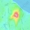

Port Renfrew
Canada > British Columbia > Capital Regional District > Juan de Fuca Electoral Area
Altitud media: 78 m
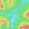
Leechtown
Canada > British Columbia > Capital Regional District > Juan de Fuca Electoral Area
Altitud media: 237 m

San Juan River
Canada > British Columbia > Capital Regional District > Juan de Fuca Electoral Area
Altitud media: 37 m

Shirley
Canada > British Columbia > Capital Regional District > Juan de Fuca Electoral Area
Altitud media: 79 m

San Juan Ridge
Canada > British Columbia > Capital Regional District > Juan de Fuca Electoral Area
Altitud media: 841 m
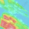
Ganges
Canada > British Columbia > Capital Regional District > Salt Spring Island Electoral Area
Altitud media: 113 m

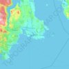

Esquimalt
Canada > British Columbia > Capital Regional District > Esquimalt > Esquimalt
Altitud media: 14 m


View Royal
Canada > British Columbia > Capital Regional District > View Royal > View Royal
Altitud media: 34 m

Fulford Harbour
Canada > British Columbia > Capital Regional District > Salt Spring Island Electoral Area
Altitud media: 110 m


PKOLS (Mount Douglas)
Canada > British Columbia > Capital Regional District > Saanich
Altitud media: 47 m


Japan Gulch Reservoir
Canada > British Columbia > Capital Regional District > Juan de Fuca Electoral Area
Altitud media: 274 m

Mayne
Canada > British Columbia > Capital Regional District > Southern Gulf Islands Electoral Area
Altitud media: 52 m

Goldstream River
Canada > British Columbia > Capital Regional District > Juan de Fuca Electoral Area
Altitud media: 247 m

Cecelia Creek Falls Park
Canada > British Columbia > Capital Regional District > Saanich
Altitud media: 36 m

Mount Parke
Canada > British Columbia > Capital Regional District > Southern Gulf Islands Electoral Area
Altitud media: 74 m

Abraham Collins' Lookout
Canada > British Columbia > Capital Regional District > North Saanich
Altitud media: 149 m

Young Lake
Canada > British Columbia > Capital Regional District > Juan de Fuca Electoral Area
Altitud media: 138 m

Strawberry Knoll Park
Canada > British Columbia > Capital Regional District > Saanich
Altitud media: 34 m

Galiano
Canada > British Columbia > Capital Regional District > Southern Gulf Islands Electoral Area
Altitud media: 82 m
Mayne
Canada > British Columbia > Capital Regional District > Southern Gulf Islands Electoral Area
Altitud media: 52 m

Mayne
Canada > British Columbia > Capital Regional District > Southern Gulf Islands Electoral Area
Altitud media: 52 m