Geolocalizar

Mapa topográfico Baracatan

Haga clic en el mapa para ver la altitud.

Acerca de este mapa

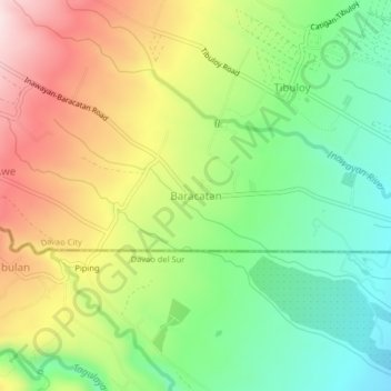
Nombre: Mapa topográfico Baracatan, altitud, relieve.

Lugar: Baracatan, Davao Region, Philippines (6.95181 125.40761 6.99181 125.44761)

Altitud media: 357 m

Altitud mínima: 174 m

Altitud máxima: 602 m

Otros mapas topográficos

Haga clic en un mapa para ver su topografía, su altitud y su relieve.

Hilongos

Philippines > Leyte

Altitud media: 111 m

Metro Manila

Philippines

The Coastal Margin or Lowland is a flat and low plain that faces Manila Bay. Located here is Manila, Navotas, parts of Malabon, and the western part and reclaimed areas of Pasay and Parañaque, where the ground elevation ranges from zero meters on Manila Bay to five meters at the west side of the cities of…

Altitud media: 43 m

Bulacan

Philippines

Altitud media: 214 m

Cavite

Philippines

Another theory proposes that the name is a Hispanicized form of kabit, Tagalog for "joined", "connected", or "attached", referring to the peninsula's topographical relation to the mainland. Edmund Roberts, in his 1821 memoir, stated that the "natives" called it Caveit due to the "crooked point of land…

Altitud media: 88 m

Batangas

Philippines

Batangas is a combination of plains and mountains, including one of the world's smallest volcanoes, Mt. Taal, with an elevation of 600 metres (2,000 ft), located in the middle of the Taal Lake. Other important peaks are Mount Macolod with an elevation of 830 metres (2,720 ft), Mt. Banoy with 960 metres (3,150…

Altitud media: 126 m

Baras

Philippines > Rizal

Altitud media: 172 m

Mindoro

Philippines > Occidental Mindoro

Mindoro is the seventh largest and eighth-most populous island in the Philippines. With a total land area of 10,571 km2 ( 4,082 sq.mi ) and has a population of 1,408,454 as of 2020 census. It is located off the southwestern coast of Luzon and northeast of Palawan. Mindoro is divided into two provinces:…

Altitud media: 173 m

Subangdaku

Philippines > Mandaue

It is one of the two (the other one being the municipality of Consolacion) local government units located within the mainland Metro Cebu where the elevation of land is less than 100 m (330 ft).

Altitud media: 10 m

Alaminos

Philippines > Pangasinan

Altitud media: 34 m

Palayan

Philippines > Nueva Ecija

Altitud media: 107 m

Luzon

Philippines

Altitud media: 88 m

Isabela

Philippines

The province is divided into three physiographic areas. The eastern area, straddled by the Sierra Madre mountain range, is rugged and thickly forested. A substantial portion is uncharted. These unexplored hinterlands are home to a rich variety of flora and fauna, and some are under government reservations. It…

Altitud media: 227 m

Palawan

Philippines

Palawan's almost 2,000 kilometers (1,200 mi) of irregular coastline is lined with rocky coves and sugar-white sandy beaches. It also harbors a vast stretch of virgin forests that carpet its chain of mountain ranges. The mountain heights average 1,100 meters (3,500 ft) in altitude, with the highest peak rising…

Altitud media: 44 m

Laguna

Philippines

Laguna is home to 24 mountains, most of which are inactive volcanoes. The highest peak in Laguna is Mt. Banahaw, with an elevation of 2,170 m (7,120 ft). Banahaw, unlike most other volcanoes in Laguna, is an active complex stratovolcano, which last erupted in 1843. Banahaw is located in the boundary of Laguna…

Altitud media: 183 m

Pangasinan

Philippines

Altitud media: 290 m

Iloilo City

Philippines

Altitud media: 17 m

Baguio

Philippines

In 1903, Filipinos, Japanese and Chinese workers were hired to build Kennon Road, the first road directly connecting Baguio with the lowlands of La Union and Pangasinan. Before this, the only road to Benguet was Naguilian Road, and it was largely a horse trail at higher elevations. Camp John Hay was…

Altitud media: 1,371 m

Parañaque

Philippines

Altitud media: 11 m

Ilocos Sur

Philippines

Ilocos Sur occupies the central section of the Ilocos Region in northern Luzon. It is bordered by Ilocos Norte to the north, Abra to the northeast, Mountain Province to the east, Benguet to the southeast, La Union to the south, and the South China Sea to the west. Its area of 2,596.00 square kilometres…

Altitud media: 468 m

Agusan del Sur

Philippines

Altitud media: 278 m

Cagayan de Oro

Philippines

Cagayan de Oro, located along the north-central coast of Mindanao, Philippines, encompasses a diverse topography that significantly influences its terrain. The city spans approximately 488.86 square kilometers (188.75 square miles), featuring a 25-kilometer (16 miles) coastline along Macajalar Bay. The…

Altitud media: 224 m

Quezon City

Philippines

In order to make Quezon's dream a reality and to mobilize funds for the land purchase, the People's Homesite Corporation (PHC) was created on October 14, 1938, as a subsidiary of NDC, with an initial capital of ₱2 million. Roces was the chairman of the Board of PHC, and they immediately acquired the vast…

Altitud media: 39 m

Bataan

Philippines

Bataan is divided by two mountain groups of volcanic origins. The northern side is composed of the Mount Natib (elevation 1,253 metres (4,111 ft)), Mount Sta. Rosa and Mount Silangan. The southern group is composed of Mount Mariveles, Mount Samat, and Mount Cuyapo. A narrow pass separates these two mountain…

Altitud media: 70 m

Mindanao

Philippines

In the eastern portion of the island, from Bilas Point in Surigao del Norte to Cape San Agustin in Davao Oriental, is a range of complex mountains, called the Eastern Pacific Cordillera, known in their northern portion as the Diwata Mountains. This range is low and rolling in its central portion. A proposed…

Altitud media: 149 m

Pampanga

Philippines

Altitud media: 122 m

Tuguegarao

Philippines > Cagayan

Altitud media: 49 m

Libertad

Philippines > Antique

Altitud media: 66 m

San Felipe

Philippines > Batangas

Altitud media: 189 m

Muntinlupa

Philippines

There are three plausible origins of the name of the city: First, is its association with the thin topsoil in the area; second, residents, purportedly replying to a question by Spaniards in the 16th century what the name of their place was, said “Monte sa Lupa”—apparently mistaking the question for what…

Altitud media: 21 m

Tacloban

Philippines

Altitud media: 23 m

Paracale

Philippines > Camarines Norte

Altitud media: 11 m

Sariaya

Philippines > Quezon

Sariaya is situated on a flat land except for a portion on the north occupying a part of the foot of Mount Banahaw. The municipality has the highest point of elevation on 3,800 feet above sea level at Barangays Concepcion Banahaw and Sampaloc Bogon.

Altitud media: 117 m

San Pedro

Philippines > Laguna

Altitud media: 29 m

Pasig

Philippines

Altitud media: 17 m

Silang

Philippines > Cavite

Altitud media: 314 m

Bacolod

Philippines

Bacólod (English: Bacolod), is derived from bakólod (Old Spelling: bacólod), the Old Hiligaynon (Old Ilonggo) (Old Spelling: Ylongo and Ilongo) word for a "hill, turtle, mound, rise, hillock, down, any small eminence or elevation", since the resettlement was founded on a stony, hilly area, now the barangay…

Altitud media: 54 m

Davao City

Philippines

Altitud media: 249 m

Zamboanga City

Philippines

The overall topography of the city could be described as rolling to very steep. There are some flat lands, mostly narrow strips along the east coast. The urban center is mostly flat with a gentle slope to the interior, ranging from 0% to 3%. A portion, about 38,000 hectares, has slopes ranging from 18% to 30%.…

Altitud media: 78 m

Caloocan

Philippines

South Caloocan, where most commercial and industrial establishments are found, lies on generally flat and highly accessible land, with slopes ranging from 0-3%. The topography gradually changes into gently to moderately sloping to rolling along the North Luzon Expressway, with slopes ranging from 3-18%. The…

Altitud media: 18 m

Panay

Philippines > Iloilo

Panay island is the sixth largest island in the Philippines by area, with a total land area of 12,011 km2 (4,637 sq mi). Mount Madja-as is the highest point in Panay with an elevation of 2,117 metres (6,946 ft) above sea level, located in town of Culasi in the northern province of Antique. Central Panay…

Altitud media: 117 m

Pasig River

Philippines

Altitud media: 21 m

Kalinga

Philippines

Large swaths of the province's lowlands are open grassland suitable for pasture, while the highlands have extensive areas of tropical rainforest. In higher elevations to the west, particularly in the mountains of Balbalan, lie some of the most intact pine forests of Luzon island. Rizal and Tabuk with their…

Altitud media: 667 m

South Cotabato

Philippines

Maximum daytime temperature throughout the province is in the range of 36 to 38 °C (97 to 100 °F), falling to 23 to 32 °C (73 to 90 °F) during the night depending on the elevation. The hottest period is January to April while July to December being the coolest.

Altitud media: 414 m

Tarlac

Philippines

Like the rest of Central Luzon, the province has three distinct seasons: summer from March to June, monsoon rain from July to early October, and monsoon winter from late October to February. Summer months, especially during May bring frequent, sometimes severe, thunderstorms with high winds, thunder, and hail.…

Altitud media: 217 m

Rizal

Philippines

Altitud media: 214 m

Angeles

Philippines

Sapangbato is the largest barangay in Angeles in terms of territory, with a total land area of 104,694 sq. meters and a population of 11,262. Located northwest of Angeles near Clark Freeport Zone, it is identified as the barangay in Angeles with the highest elevation of 750 feet above sea level. It is home to…

Altitud media: 98 m

Ipo Dam

Philippines > Bulacan > Norzagaray > Ipo

The spill level of the dam is at an elevation of 101 metres and it has seven radial floodgates. The watershed topography is characterised by mountainous terrain similar to the Angat Reservoir Watershed with moderate forest cover. The watershed has an area of about 70 square kilometers and receives an average…

Altitud media: 174 m

Loyola Heights

Philippines > Quezon City

Altitud media: 46 m

Bohol

Philippines > Bohol

Altitud media: 77 m

Antipas

Philippines > Cotabato

Temperature ranges from 23 to 32 degrees Celsius, because of its topographic elevation of 320 meters above sea level and proximity to mountainous Bukidnon province, making it one of the cool places in Soccsksargen. The highest temperature is felt during the months of March and April, while the lowest is in…

Altitud media: 297 m

Hijo River

Philippines > Davao del Norte > Apokon

Altitud media: 47 m

Calatrava

Philippines > Negros Occidental

Altitud media: 123 m

Laguna de Bay

Philippines > Laguna

Laguna de Bay (Spanish for "Lagoon/Lake of Bay"; Tagalog: Lawa ng Bay, [baɪ]), also known as Laguna Lake, is the largest lake in the Philippines. It is located southeast of Metro Manila, between the provinces of Laguna to the south and Rizal to the north. A freshwater lake, it has a surface area of 911–949…

Altitud media: 62 m

Santa Rosa

Philippines > Laguna

Altitud media: 26 m

Apayao

Philippines

Altitud media: 401 m

Zamboanga Sibugay

Philippines

Altitud media: 107 m

Ilocos Norte

Philippines

Altitud media: 262 m

Capiz

Philippines

Capiz covers a total area of 2,594.64 square kilometres (1,001.80 sq mi) occupying the northeastern portion of Panay Island, and is one of the five provinces that compose the Western Visayas region. Mount Nangtud, is the highest mountain in Capiz with an elevation of 6,804 ft (2,074 m) located in the…

Altitud media: 123 m

Calabarzon

Philippines

Altitud media: 99 m

Davao de Oro

Philippines

Altitud media: 361 m

Bicol Region

Philippines

Altitud media: 35 m

Virgen

Philippines > Bohol > Anda

Altitud media: 86 m

Surigao del Sur

Philippines

Altitud media: 128 m

Nabas

Philippines > Aklan

The Municipality of Nabas is considered as rolling terrain and rugged terrain land topographic formation. It has an elongated land area situated along the Northwestern Panay Peninsula, with 21-kilometer coastline facing Sibuyan Sea, and with such a large span of municipal waters, approximately 300 square…

Altitud media: 71 m

Talibon

Philippines > Bohol

Altitud media: 11 m

Benguet

Philippines

The province suffers from crop damage resulting from seasonal frost during the cold months of December to March, especially in high-altitude towns such as Atok, Buguias, Mankayan and Kibungan. In February 2007, Benguet suffered crop damage due to temperatures reaching as low as 7 °C (45 °F).

Altitud media: 908 m

Montalban

Philippines > Rizal

Rodriguez is generally very rough in topography, with 83% of its total land area composed of upland areas, hills and mountain ranges. The remaining 17% low-lying terrain and rolling lands are found at the south-western portion of the municipality, along with the northern portions of the Municipality of San…

Altitud media: 230 m

Sulu

Philippines

Altitud media: 10 m

Kawit

Philippines > Cavite

Altitud media: 5 m

El Nido

Philippines > Palawan

Altitud media: 18 m

Leyte

Philippines

Altitud media: 76 m

Malolos

Philippines > Bulacan

Malolos is relatively flat of about 0.81% to a gently sloping of 2.17%. The slope of the land descends towards west, southwest to southern direction. The highest land elevation is at about 6.0 m (19.7 ft) above sea level while the lowest is only 0.5 m (1 ft 8 in) below sea level. A network of natural waterways…

Altitud media: 4 m

Malilipot

Philippines > Albay

Altitud media: 262 m

General Santos

Philippines

Altitud media: 197 m

Kalilangan

Philippines > Bukidnon

Altitud media: 860 m

Marilao

Philippines > Bulacan

Altitud media: 10 m

Iloilo

Philippines

The province is divided into two distinct geographic regions; the highlands of the Central Panay Mountain Range on the western border and the lowland plains which account for a larger portion of the province. Small islands east of its northernmost tip also dot the Visayan Sea - of these, Pan de Azucar and…

Altitud media: 129 m

Palompon

Philippines > Leyte

Altitud media: 31 m

Lucena

Philippines

Altitud media: 24 m

Dasmariñas

Philippines > Cavite

Dasmariñas is partly lowland and partly hilly. The Poblacion itself is elevated. From an elevation of 80 meters (260 ft) at the Poblacion, the land rises to 250 meters (820 ft) towards Silang. Generally, land near rivers and creeks are rugged. Dasmariñas is outside the typhoon belt and has no fault line…

Altitud media: 126 m

Siquijor

Philippines

The island lies about 19 kilometres (12 mi) east of the nearest point on southern Negros, 25 kilometres (16 mi) southeast of Cebu, 30 kilometres (19 mi) southwest of Bohol, and 45 kilometres (28 mi) north of Zamboanga del Norte in Mindanao. It is predominantly hilly and in many places the hills reach the sea,…

Altitud media: 17 m

La Union

Philippines

Topography

Altitud media: 442 m

UP Campus

Philippines > Quezon City

Altitud media: 59 m

Batangas City

Philippines > Batangas

The city is the center of the radio listening market in Batangas, and is served by local radio stations, as well as some radio stations from Lipa and other parts of the Mega Manila area. The Roman Catholic Archdiocese of Lipa, through the Radyo Bayanihan System, hosts two local radio stations: ALFM 95.9 Radyo…

Altitud media: 65 m

Catanduanes

Philippines

The topography of Catanduanes Island is rugged and mountainous, becoming more pronounced towards the central portion of the island. Less than 10 percent of the land area has a slope gradient under 8 percent, mostly fractured and narrow strips of plains located along the coastal areas where most of the…

Altitud media: 35 m

San Leonardo

Philippines > Nueva Ecija

Altitud media: 28 m

Talim Island

Philippines > Rizal > Kinaboogan

Altitud media: 13 m

Marinduque

Philippines

The highest peak in Marinduque is Mount Malindig (formerly called Mt. Marlanga), a potentially active stratovolcano with an elevation of 1,157 metres (3,796 ft) above sea level, located at the southern tip of the island.

Altitud media: 38 m

Masbate

Philippines

The general surface configuration of the province ranges from slightly undulating to rolling and from hilly to mountainous. In each island, the rugged topography is concentrated in the northeastern portion and gradually recedes to blunt hills and rolling areas in the south, southeast, and southwest.

Altitud media: 28 m

Bukidnon

Philippines

Situated within Bukidnon is Mount Dulang-dulang, the 2nd highest mountain in the country, with an elevation of 2,938 metres (9,639 ft) located in the Kitanglad Mountain Range. Mount Kitanglad (2,899 m), Mount Kalatungan (2,860 m), Mount Maagnaw (2,742 m), Mount Lumuluyaw (2,612 m), and Mount Tuminungan (2,400…

Altitud media: 686 m

Abra

Philippines

Altitud media: 601 m

Sorsogon

Philippines

The province has an irregular topography. Except for landlocked Irosin, all the towns lie along the coast. They are all connected by concrete and asphalt roads. Mountain's sprawl over the northeast, southeast and west portions. Mount Bulusan, the tallest peak, rises 1,560 metres (5,120 ft) above sea level.

Altitud media: 51 m

Lanao del Sur

Philippines

Altitud media: 637 m

Antique

Philippines

Mount Madja-as is located in Culasi, is the highest peak on the island of Panay. This 2,117-metre-high (6,946 ft) mountain is a dormant volcano with lakes and 14 waterfalls. It is said to be the legendary home of Bulalakaw, the supreme god of the ancients, and beckons as a challenge for hikers and trekkers.…

Altitud media: 53 m

Dumangas

Philippines > Iloilo

Altitud media: 8 m

Agoo

Philippines > La Union

Altitud media: 57 m

La Trinidad

Philippines > Benguet

The terrain is generally mountainous with springs, rivers and creeks. The town has a valley which encompasses several barangays. The valley floor elevation is at 1,300 metres (4,300 ft) above sea level. Elevation ranges from 500 to 1,700 metres (1,600 to 5,600 ft) above sea level.

Altitud media: 1,123 m

Luciano

Philippines > Cavite > Trece Martires

Altitud media: 131 m

Zamboanga del Sur

Philippines

Altitud media: 158 m