
Mapa topográfico Steig
Haga clic en el mapa para ver la altitud.
Steig
Der Ortsname stammt vom mittelhochdeutschen Wort steig(e) für steile Straße bzw. Anhöhe ab.
Acerca de este mapa
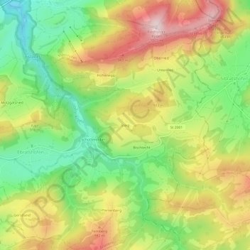
Nombre: Mapa topográfico Steig, altitud, relieve.
Altitud media: 844 m
Altitud mínima: 665 m
Altitud máxima: 1,051 m
Otros mapas topográficos
Haga clic en un mapa para ver su topografía, su altitud y su relieve.